

Frequently Asked Questions
How do I know what is genuine?
In the accepted terminology of map dealers and collectors, there are several words or expressions which can cause some confusion or question in the minds of the inexperienced. Amongst these, phrases such as 'original/genuine old/antique print/engraved map', 'a good copy', 'a fine impression', 'a late edition', etc spring to mind.
The honest dealer or map expert should be able to explain any of these terms - not least by being able to specify the date of publication of that particular map on that particular piece of paper. Many new collectors are surprised to find sixteenth- or seventeenth-century maps printed on strong paper and in good condition. 'Surely it is a later reprint?', 'How can it look so fresh?' they ask. The answers are that paper produced prior to around 1800 was generally of a much better quality than that produced more recently; that the life of a copper-engraved plate was relatively limited in terms of usage without being re-engraved; furthermore, the demand for an out-of-date map was negligible, and so the copper engraving would be scrapped, hammered out or melted down. Copper - the most commonly used medium for over 200 years - was an expensive material and, consequently, had to be reused for newly produced maps.
Many new collectors, wary in the knowledge that a number of decorative and sporting scenes are still being printed from nineteenth-century engravings, have initial fears that this must also apply to maps. Although a few of the original engraved plates survive, in my experience, none have been used to print maps commercially in recent times. Simply from a commercial point of view, mass production of a rare map will depress the market, making the product unsaleable. Unfortunately, there are no golden rules to guide the inexperienced map buyer. Experience and confidence will be gained only by seeing the genuine item.
1. The paper In the most general terms the majority of papers used for map printing were hand-made and of good quality. On close examination both visually and with the fingertips, the surface of the paper will probably appear very slightly rough or lightly textured with earlier paper tending to be more rough than that of a later period. When held up to the light a watermark (possibly) and chainlines (certainly) should be visible - these are the impressions left by the grid on which the layer of pulp was left to dry.
2. The printed line itself Depending on whether a woodblock or copperplate process of printing was used there may be evidence of the 'impression' made by the printing block on its surfaces, which have actually come into contact with the paper. The 'blockmark' of the copperplate engraving will often be visible around the edge (the impression left by the edge of the copperplate after being pressed onto the paper).
An understanding of the two factors above should be able to confirm the information visually available on the map. For example, is the heavy, rather rough paper with strongly printed lines compatible with the geographical information, map maker's name and date engraved on the map? A little experience will soon build confidence.
The expression - 'a fine/poor copy' is often misunderstood - not surprisingly! For 'copy' use 'example'. The word 'copy' as used over the years is generally understood to mean reproduction. However, in this case, it applies to reproduction of the printing process in the course of a print run and not to reproduction of that engraving at a later date.
What is "original"?
As with the word 'copy', confusion sometimes arises over the accepted definition of the term 'original' - particularly when it is used to describe a subsequent reissue of a map.
With few exceptions engraved maps were published in more than one edition, or issue. In many instances copperplates were reprinted over a period of time with alterations engraved on the map. For example: new geographical information was added or the publisher's imprint was altered; sometimes variations occurred regarding the book format (in size, or map location on a page of text); different language text was used. Sometimes at a later date the copperplate simply showed signs of age or wear.
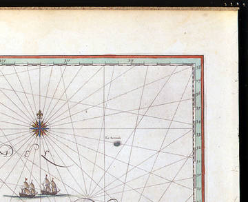
![]()
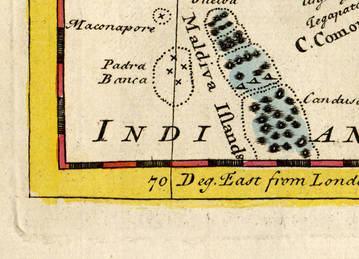
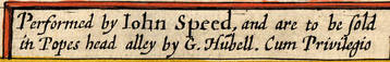
In any of these instances the map is still 'original' although it may not be in its first edition. Thus, a 1676 edition of one of John Speed's maps is just as 'original' as the 1610-11 first edition of the same copperplate.
With regard to the age of the colour on a map, again experience is the surest guide. A map in 'early', 'original' or 'contemporary' colour (i.e., contemporary with publication of the map) may look surprisingly bright and fresh - early colour need not appear sombre or faded. As the work of various map makers is examined it will be apparent that many maps have a style of colouring which typifies the period. Ortelius, Hondius and Mercator, Blaeu and the English, Dutch, French and German schools of map making all used certain colours in clearly identifiable ways.
Maps, of course, that were issued in black and white - as virtually all until the nineteenth century were - may have been coloured at any time since publication. Clues as to the age of colour are few and the fact that there are now expert map colourists at work who can colour a map in the right style, with the correct colours, further complicates the issue. In most instances the acid base of the early verdigris green mixture used by colourists will show some 'see through' on the reverse of the map - in extreme instances the verdigris will bite through the paper and the whole area covered in that green might drop out or disintegrate - rather unfortunate proof of 'original colour'.
How many were printed?
This inevitable question is not one that is easily answered. In only a few instances has research provided estimates of original production. Unfortunately, publishing houses of the past either did not keep precise records or, if they did, these have not survived for our examination. However, it is acknowledged that a copperplate would last, without the need for re-cutting or re-engraving, for approximately 1000 'pulls' (i.e., impressions taken). Many of the more common maps show evidence of this re-engraving process.
One might reasonably assume then that an average production number for copperplate maps of the seventeenth and eighteenth centuries would have been in the region of some hundreds (in the case of known rarities such as Gerard de Jode's maps) or as many as a few thousand (estimated at between seven to eight thousand in the case of some of Abraham Ortelius' particularly popular maps, certain of which were published between 1570 and 1612 in over forty editions in seven different languages). Excluding separately issued maps and considering only those bound into atlases or books, it would be reasonable to assume that, even with the most popular atlases, production would not number more than a couple of thousand copies – of which, of course, only a very small proportion might have survived. Recent research suggests survival rates of around eight to over twenty per cent for any of the Ortelius maps, relatively few of which were published in every edition of his atlas.
Given a survival rate as high as 20 per cent, the actual number of any one particular map on the market, or which might become available to collectors, is still a tiny proportion of the original printing. Furthermore, of these 'few hundred' that may still be extant, a great number will be in libraries or public or private collections, and will not appear on the open market.
How much must I spend?
I don't believe there has ever been a map dealer or collector who has not, at some point, looked back in time at map prices and cursed himself for not spending or buying more in the past - this will always be the case. However, maps can still be found for a few pounds but, inevitably, the better and more interesting the item the more expensive it will be. Miniature maps of the seventeenth-century can be found below one hundred pounds with folio maps more expensive but there are still many eighteenth- and nineteenth-century maps below that figure.
Unlike the relatively similar hobbies of stamp or coin collecting, there is no exhaustive catalogue summarising the values of maps. This is not just because of the numbers of different maps that have been published - no more than the numbers of stamps - but
because each map on the market has to be judged on unique factors, in particular, that map's condition and colour.
What about condition?
Ideally, any map might be found in perfect condition. 'Perfect condition', 'mint', 'extra fine' and other superlatives would imply that the map is in exactly the same state as when published (i.e., with no damage and no repairs). However, unfortunately, this is not always the case.
 1. Centrefold One of the most common defects found in maps is a problem at the centrefold. The greater number of printed maps now on the market were issued
in books and, invariably, spread across two pages rather than covering just one. In the earliest publications 'stitchmarks' - where leaves have been sewn into the spine of the volume - may be encountered. This defect to maps pre-dating c 1520 is common and one must judge the degree of damage caused and the extent and quality of any subsequent repair. Although the woodblock maps of Sebastian Munster also often have this problem, the majority of maps issued during the remainder of the sixteenth century were bound into their volumes on 'guards' (for simplicity of printing and superior presentation the map, unlike the text, was printed on a double folio sheet; this was folded and then attached, by a tab, or 'guard' into the spine) and were better protected by this method. Nevertheless, the regular opening, flattening out and refolding of a volume of maps in day-to-day use frequently created wear at the centrefold, often resulting in a tear or split, normally at the bottom of the fold. This can be repaired and there should not be any loss of print. In extreme cases a split might extend the length of the fold and careful examination is required to ensure that no actual print surface is missing.
2. Tears Tears, either as a consequence of a centrefold split, or on the edges of the map sheet may be encountered. Tears can normally be well repaired but, particularly if they extend onto the map's surface, they will devalue the map. Thinness, or weakness, within the actual fabric of the material may be found. Quite often an area of almost tissue-thin paper appears within an otherwise perfect sheet of paper. Given the inconsistencies of the hand-made process, providing the face of the paper on which the map is printed is complete and intact, this is not a serious problem. My suggestion would be to 'back' the thin area with archival material to guarantee the strength and stability of the map.
 3. Margins Similar maps on different-sized sheets of paper may be found. This will normally be the result of the atlas or book, having been 'rebound' at some stage and 'trimmed' by the binder. Alternatively, the map may have come from a 'de luxe' or 'special' edition of its atlas or book. The maps from Blaeu's “Atlas Major” or from early editions of John Speed's “Theatre...” often have larger margins than those from other editions. Wider margins are preferable on maps although in many instances the margins are no larger than a half inch or so. The presence of the printer's 'blockmark' is important around the edge of the map, although occasionally a map may have been trimmed to the very edge of the printed area. Trimming close in this instance may have been done at the time of publication if the map was to be bound in a composite atlas. In such a case it is again necessary to make a judgement as to the effect of the defect on the map and the likelihood of finding the map in pristine condition, taking into account the consequent price differential.
4. Wormholes Maps of most periods may be found with small circular holes caused by bookworms. These small insects may have bitten away notable pieces of the page and although repairs can disguise the damage, any loss of printed detail may be seriously detrimental.
5. Staining Many atlases and maps have, at some time, suffered from staining of some nature. Usually water stains can be cleaned from the paper, but if there should be any oily content in the original staining liquid this may prove immovable. Tobacco stains and candle wax drops often leave permanent spotting. Yet again, the degree of disfiguration should be weighed against the price differential of a fine copy.
Are there problems relating to colour?
1. Verdigris damage The evidence of early colour on a map is often 'that the green shows through on the reverse of the map'. However, there are times when, either due to the original acid content of the verdigris mixture, or because the map or atlas has been kept in a damp atmosphere for some time, the areas coloured green have simply disintegrated. In the case of outline colour, the result may be that the area bounded by green simply 'falls out' of the map, or where a map area is covered in a green wash this will flake and disintegrate. If this problem is identified before any loss of surface, then backing the troubled area with archivist's tissue is the best remedy. Providing there is no loss of surface and any acidic activity has been halted the map should not be seriously devalued.
2. Colour (and print) offset This will either manifest itself as a faint mirror image transposed onto the opposite page or may be seen where the paint has attached itself to the opposite page and in some case lifted the paper surface away with it. Occasionally, the colour and damaged attached surface can be lifted and replaced correctly. Rarely though can print offset be removed. This offset will probably be the result of binding the map and closing the book before the ink or colour on the sheet had properly dried, or because the book has been kept in a damp atmosphere and the moisture has reacted with the ink or colour, and made it spread to any facing fibres.
 3. Foxing Smallish (penny-sized) brown spots, most commonly found on nineteenth-century paper, which are probably due to poor paper production and the subsequent effects of damp. Foxing can be removed by cleaning processes but these will also remove any colour on the map.
Do you buy maps?
Yes. Our stock has come from a variety of sources, but, increasingly, we are buying from private individuals. Family heirlooms and the dispersion of estates form a large part of the supply of maps now on the market, along with library and institutional disposals, and we are always keen to acquire interesting items. If an item is not for us, if we can, we will be happy to advise where you might best try to sell it.
As members of the Antiquarian Booksellers’ Association, we are pledged to offer fair prices for any purchases with payment, usually, on delivery. Sale by auction can be delayed, hit or miss, and you wait for payment after the auction house has taken perhaps 30%.
Why is a map worth so much or, of course, so little?
As you will see from a tour of our gallery or website, maps can range in price from forty or fifty pounds to many thousands. So what determines the price of a map? The answer is that there is no single factor but a combination of relative comparables. You will also see, by comparison across the market, that there are no “set” prices for specific maps as each is dependent on variable factors such as condition and attractiveness of colouring.
Factors influencing a map’s price include:
- The region shown.
Certain areas of a country or the world are more sought-after than others. For instance London and the Home Counties are more in demand than rural counties; the United States are more in demand than South America. Think in terms of property prices as a comparison. - The age of the map.
Earlier maps tend to be more decorative and less detailed than later, more utilitarian productions. However, detailed (albeit less elaborate) maps may be preferred for their precision and informative content. - The mapmaker.
Certain mapmakers are renowned for producing particularly fine and decorative cartography, others for a unique style or attention to detail. - The condition of a map.
A premium attaches to a particularly fine example of an old map, however, the age, quality of paper, intended usage and relative scarcity of a sheet map also has to be considered. Many maps are expected to have small defects, such is the nature of old, delicate items, but those with serious defects should, in general, be avoided. - The appearance.
Is the map appealing to look at? Are the colours good and well applied. Most maps with colour were originally printed black and white and have had colour added by hand – perhaps at, or around, the time of publication (usually termed old, or original, colour), or they may have been coloured at any time since, including recently. General consensus is that modern colour, providing well applied in the correct style, is acceptable. - Rarity.
Some maps were simply produced in higher quantities than others. Some maps have had a higher “mortality” rate than others due perhaps to poor quality paper or greater usage over the years. Some mapmakers and regions have been more sought-after than others so, for instance, Speed’s maps of the Welsh counties will be less expensive than those of Middlesex and Surrey, or Blaeu’s maps of France less sought-after than his of America.